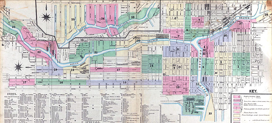
Sanborns fire insurance maps from 1868-1869, showing Chicago before the Fire of 1871, have been digitized by the Boston Public Library’s Norman B. Leventhal Map Center.
Click on an area below to go to a specific page.