
These are direct links to historic maps online. For entire collections, see also Sources and links.
 |
varies |
 |
1834 |
 |
1846 |
 |
1851 |
 |
1853 | Phelps, Fanning & Co. map of Chicago |
 |
1853 |
 |
1854 |
 |
1855 |
 |
1857 |
 |
1859 |
 |
1863 indexed |
 |
1870 | map of central Hyde Park |
 |
1872 |
 |
1872 |
 |
1873 |
 |
1877 |
 |
1877 |
 |
1878 |
 |
1880 |
 |
1880 |
 |
1881 |
 |
1881 |
 |
1882 |
 |
1883 |
O.W. Gray & Son map of Chicago |
 |
1886 |
 |
1886 |
 |
1887 |
 |
1888 |
Cram map of Chicago |
 |
1889 |
 |
1889 |
Rand McNally map of Chicago |
 |
1890 |
 |
1892 |
 |
1895 |
 |
1896 |
 |
1898 |
 |
1898 |
 |
1899 |
 |
1899 |
 |
1900 |
 |
1900 |
 |
1901 |
 |
1901 |
 |
1901 |
 |
1902 | Rand McNally map of Chicago railroads |
 |
1902 | Chicago quadrangle 15-minute topographic map |
 |
1902 | Riverside quadrangle 15-minute topographic map |
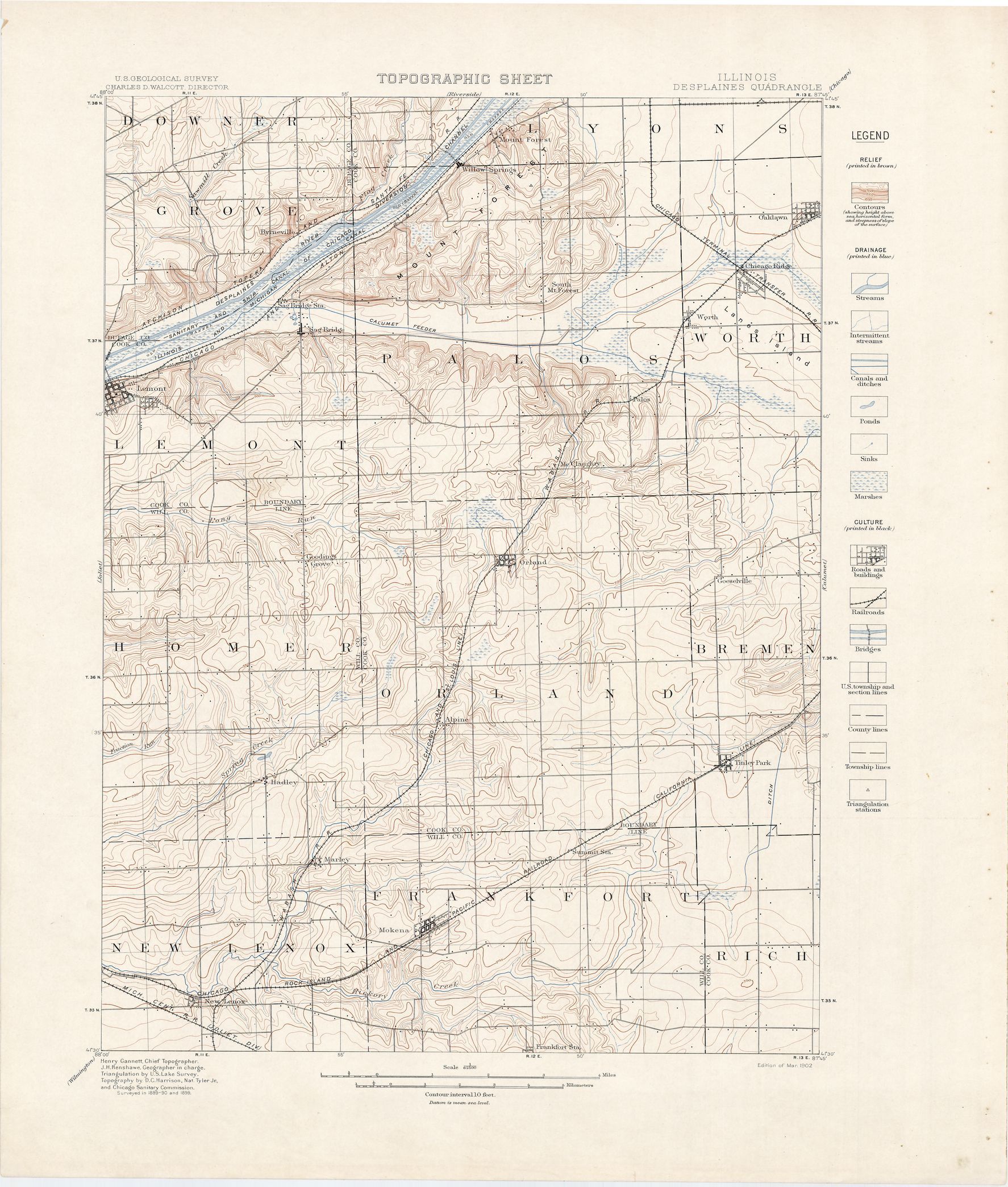 |
1902 | Desplaines quadrangle 15-minute topographic map |
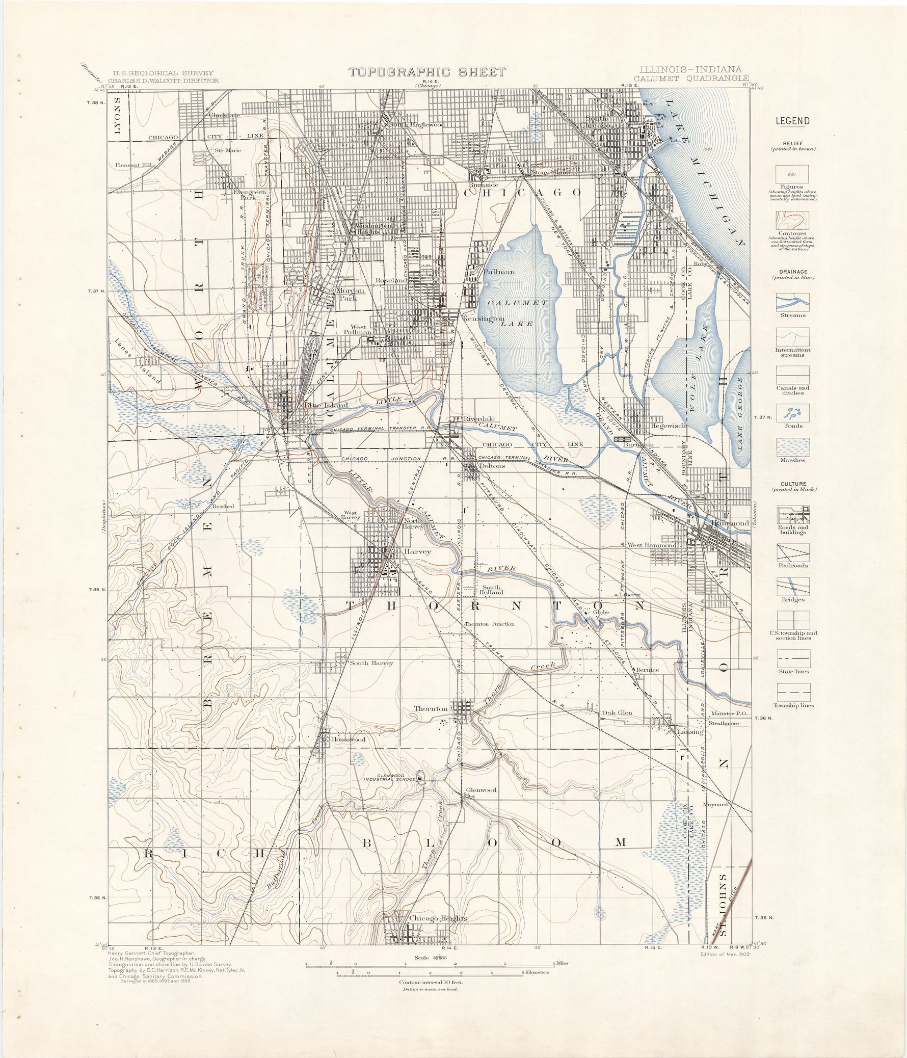 |
1902 | Calumet quadrangle 15-minute topographic map |
 |
1906 |
|
1906 | Bibliographisches Institut in Leipzig map of Chicago |
 |
1907 |
 |
1909 |
 |
1909 |
 |
1912 |
 |
1912 |
 |
1914 |
 |
1914 |
Rand McNally map of Chicago & vicinity |
 |
1921 | Rand McNally map of Chicago railroads |
 |
1921 |
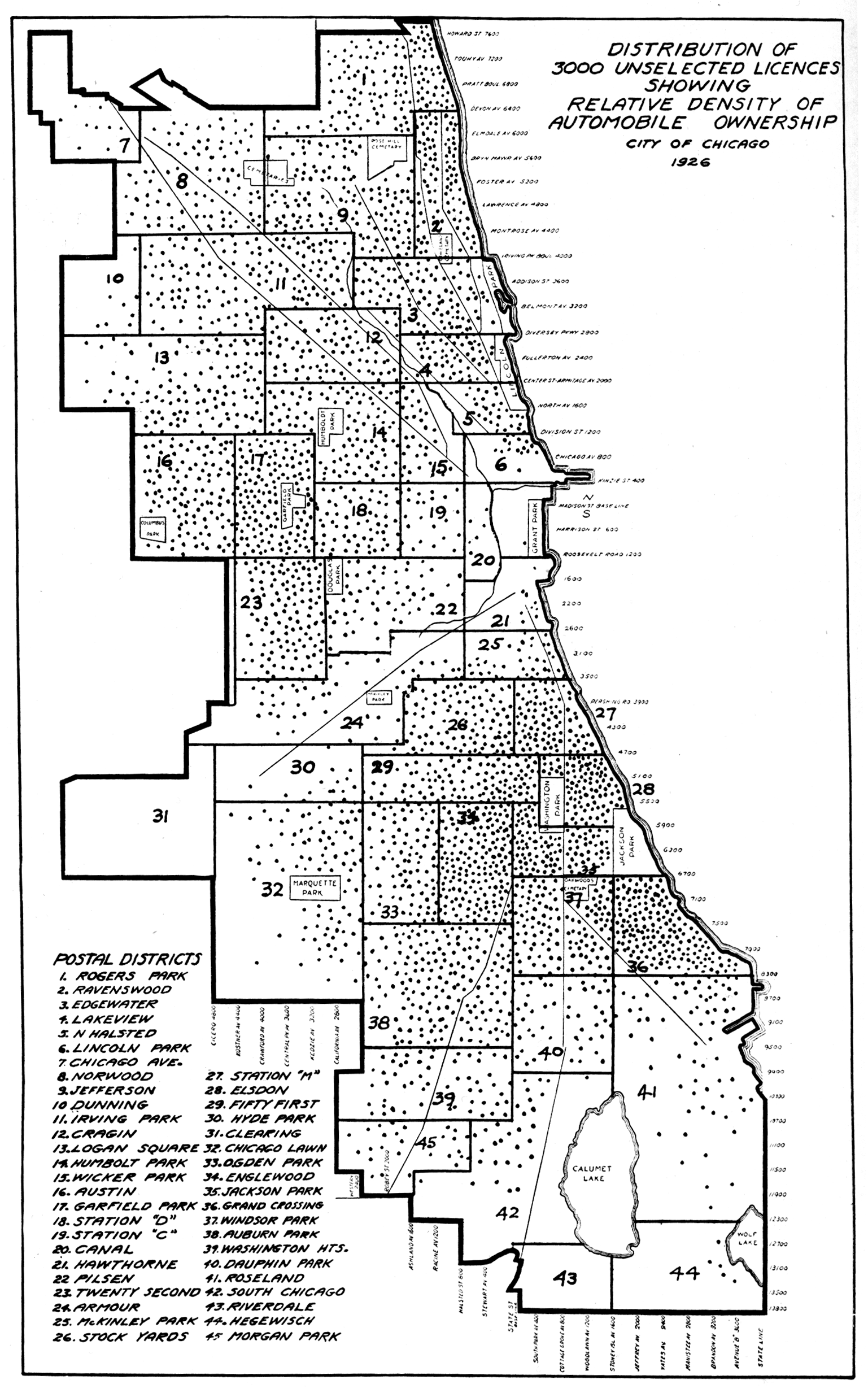 |
1926 | Distribution of licensed drivers |
 |
1927 |
 |
1928 |
 |
1934 | Chicago Tribune map of Chicagoland |
 |
1937 | Rand McNally street map, including suburbs |
 |
1940 |